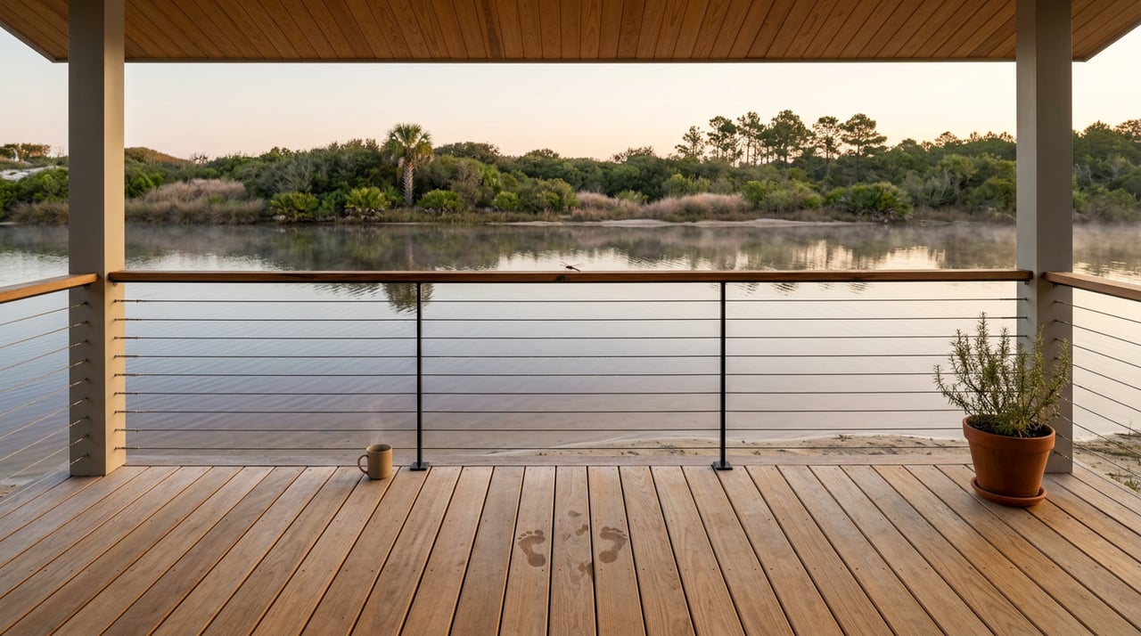
Anyone who lives on the west end of Scenic 30A learns the lakes before they learn the restaurants. The Gulf gets the postcards, but the five coastal dune lakes tucked behind the primary dune line are what give Dune Allen its cadence. When they breach, the beach changes overnight. When they close back up, the shoreline resets. Reading that rhythm is what separates a west-end resident from a first-time renter squinting at a footbridge, and this July it is worth a fresh look.
Coastal dune lakes exist in only a handful of places worldwide, and the 30A corridor has fifteen of them, running west to east from Fuller Lake through Morris, Campbell, Stallworth, Allen, Oyster, Draper, Big Redfish, Little Redfish, Alligator, Western, Eastern, Deer, Camp Creek, and finally Lake Powell. Dune Allen holds five of those fifteen inside its own zip code, which is why the neighborhood carries the nickname "South Walton's all-natural." If you live here, you already own a piece of the world's rarest freshwater-saltwater hybrid habitat. The question is what to do with it in a working summer week.
Not every lake behaves the same way, and confusing them is the fastest way to make a Saturday plan that will not work.
| Lake | Access from Dune Allen | What it's for |
|---|---|---|
| Morris | Inside Topsail Hill Preserve State Park, west boundary | Photography, hiking; no private boats |
| Campbell | Topsail Hill Preserve | The one lake in the park with rental kayaks and paddleboards |
| Stallworth | Walk-in only, along the beach from a public access | Solitude, birding; mostly private frontage |
| Allen | North side of 30A, viewable behind Stinky's Fish Camp | Fishing, brunch views; outfall runs under the road |
| Oyster | Pedestrian footbridge just off 30A | Sunrise paddles, the neighborhood's signature outfall |
That last column is the point. Stallworth is largely inaccessible without a beach walk from a public access, and Allen Lake outfalls through a hidden culvert beneath 30A rather than opening across the sand. If a visiting friend asks where to see a "real" outfall, Oyster is the one to point them toward.
The lakes sit behind sand berms, sometimes only a few feet from the Gulf. The freshwater content stays separated from the salt water by that natural berm, until a heavy rain or other inflow breaches it and floods fresh water openly into the Gulf. That event is called an outfall, and it is also the moment when salty seawater can flood back into the lake until levels stabilize, producing a rare brackish ecosystem that hosts both fresh and saltwater species.
Two practical consequences follow from that mechanism.
First, salinity is not fixed. Water can flow in both directions depending on tide levels and weather, so a lake that was fully fresh in May can turn significantly saline by August. That is why anglers on Allen Lake sometimes pull largemouth bass and speckled trout out of the same afternoon, and why fishing license requirements shift with the water conditions rather than the address.
Second, the outfall channel itself is a hazard, not a swimming hole. When the lake is open to the Gulf the currents can be swift; the standing local rule is to observe from the edge rather than wade into a moving channel. Summer rain builds lake levels quickly, so July and August are the months when residents actually see fresh breaches carve new paths through the sand.
Most visitors treat the pedestrian bridge over the Oyster Lake outfall as a scenic detail. It is not. It is the result of about sixty years of arguments between the county, private landowners, and the water itself.
For many years pilings under the bridge allowed a natural ebb and flow between lake and Gulf. In the 1960s a culvert replaced the pilings, but it was installed improperly, keeping the lake level artificially high; that situation was finally remedied in 2014 with the current bridge. The scale of the water underneath is easier to appreciate once you know the numbers: a 1998 study for the Florida DEP by A.E. Browder and R.G. Dean determined that the Oyster Lake outfall has a sweep of roughly 400 feet, meaning its intersection with the Gulf during a drain event can land anywhere along that east-west line.
The reinforcement most residents walk past without noticing is engineered too. The channel measures twelve feet deep, sides sloped at a 3H:1V gradient, five hundred feet long, and more than two thousand square yards of a high-performance turf reinforcement mat and engineered earth anchors were installed to armor it. That project earned its keep almost immediately. Hurricane Michael made landfall sixty miles east as a Category 4, and the vegetated slopes of the Oyster Lake outfall withstood the winds, storm surge, and rainfall, protecting nearby homes, Highway 30A, and the bridge itself.
None of that is legible from a Saturday walk. But if you own on Oyster, on Allen, or on any lot that drains toward the lake system, it is the reason your street is still where you left it.
Renters cycle through in weekly blocks. Residents can string these places together on a Wednesday.
Start with the water. Oyster Lake is accessible from the footbridge in the heart of Dune Allen, and it rewards a sunrise paddle before the wind picks up off the Gulf. If you want a rental kayak or paddleboard the same morning, drive west into Topsail Hill Preserve; the state park does not permit private boating on Morris Lake but does offer canoe, kayak, and stand-up paddleboard rentals on Campbell Lake.
From the water, roll onto the trail. The Timpoochee Trail is an 18.5-mile paved path that runs directly parallel to 30A, and cyclists on it pass the shores of Oyster Lake and Allen Lake with natural stops for photos. The eastward ride from Dune Allen to Gulf Place is a twenty-minute pedal, past enough dune vegetation to remind you why the community draws people who prefer trees to town squares.
For lunch, Allen Lake has the view. Stinky's Fish Camp sits on the north side of 30A with a boardwalk behind the restaurant looking out over the water, and its Sunday Jazz Brunch has become a fixture for a Cajun-inspired menu built around the lake. If Sunday brunch is booked, the neighborhood's other anchors carry the rest of the week: Goatfeathers for the low-key seafood lunch, Pizza by the Sea for the family dinner that started here and now has outposts in Miramar Beach, WaterColor, and Seacrest.
For sunset, Vue on 30A does the job. Vue has been serving from a dune-top perch since 1971, with a culinary program that draws consistent regional recognition, and chefs Mayhue and Hughes work a Gulf-to-table menu tuned to 30A ingredients. The windows face west. Time it to the sun.
Push further west and Dune Allen ends at one of the least-touched parks in the state. Topsail Hill Preserve State Park protects 3.2 miles of secluded beaches with dunes towering over twenty-five feet. The park is also the answer to a question you cannot ask anywhere else on 30A: Seahorse Reef, an artificial reef deployed in the shape of a seahorse, sits roughly 715 feet offshore, close enough for a strong swimmer and worth a snorkel on a flat morning.
A working local rule for the summer: after any rain event of an inch or more, check the Oyster Lake footbridge before the next tide. That is when the outfall shows you what it is doing.
For residents planning the rest of the season, the pattern to hold in your head:
Living in Dune Allen is not about being close to the beach. Every neighborhood on 30A is close to the beach. It is about living inside a working coastal dune lake system, which is a claim only a handful of addresses in the world can make. The rhythm of outfall, breach, and closure is the actual daily texture of the west end. Learn it, and the neighborhood tells you when to paddle, when to fish, when to bike, and when to stand on a footbridge and watch tea-colored water carve a new path to the Gulf.
If you own property here and are weighing what the next chapter of that ownership looks like, The Spears Group is happy to talk through it. Request a complimentary market valuation and luxury marketing plan when you are ready.
Office 2048 West County Hwy 30A #107 Santa Rosa Beach FL 32459
Office 2048 West County Hwy 30A #107 Santa Rosa Beach FL 32459